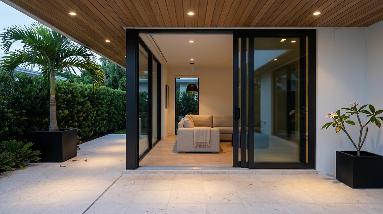
If you love to boat, Lighthouse Point can feel like paradise. But not every waterfront home delivers the same access to the ocean. Bridge heights, inlet shoaling, no‑wake zones, and dock rules can change how you use your boat day to day. This guide gives you a clear, local look at what matters before you buy or sell, so you can plan with confidence. Let’s dive in.
Information current as of March 16, 2026. Always verify with the cited agencies before you rely on it.
Ocean routes at a glance
Most Lighthouse Point homes reach the Atlantic through Hillsboro Inlet directly to the east. It is the closest and most common route for center consoles, sportfishers, and smaller yachts. Some owners choose Port Everglades to the south, but that adds distance and involves a busy commercial harbor with added rules.
If you plan to use Port Everglades, review the port’s regulated navigation and security zones in advance. You can find those details in the Coast Guard rules for Port Everglades’ regulated areas, which outline how recreational boats share space with commercial traffic. See the federal description of the port’s security zones and controls for context in the regulated navigation and security zones.
Hillsboro Inlet essentials
Hillsboro Inlet offers quick access but demands attention. The inlet channel shifts, depths change with shoaling, and currents can run strong. The Hillsboro Inlet District’s depth soundings and cautions note that sands move and that conditions can be hazardous for unfamiliar operators.
Bridge clearance and timing
The SR‑A1A drawbridge at the inlet has a reported closed vertical clearance of about 13 ft and opens on a regulated schedule. Check your boat’s air‑draft against the closed height and plan your timing if you need an opening. You can confirm the bridge’s closed clearance and typical opening schedule on this bridge listing.
Shoaling, currents, and local knowledge
Depths near the inlet and along the ICW change. Maintenance dredging occurs, then shoals move again. Treat any “deep water” claim as a snapshot. For background on recent maintenance work in the region, see this report on Intracoastal Waterway maintenance dredging. Always pair that context with the latest local soundings and the Coast Guard’s Local Notice to Mariners before you go.
Bridges and clearances
Measure your boat’s highest fixed point and compare it to every bridge on your route. The Hillsboro A1A bridge’s approximate 13 ft closed clearance means many flybridge boats and towered center consoles will time openings. Keep a tide cushion in mind, since clearance boards and water levels vary.
A smart process is simple:
- Measure air‑draft at your loaded waterline.
- List every vertical obstruction from dock to inlet.
- Confirm clearances with current NOAA charts and the bridge tender.
- Build in timing for scheduled openings when needed.
Canal depths and drafts
Residential canal depths vary. Federal channels like the ICW are maintained to target depths, but private finger canals are not. Sediment, construction history, and maintenance make each property unique.
Do not rely on a listing descriptor alone. Ask for recent soundings at the dock, then verify with a marine surveyor when draft is tight. If you are evaluating a yacht or a large center console, make a professional dock‑sounding a standard contingency.
Speed zones and travel time
Expect slow‑speed segments near bridges, ramps, marinas, and inlet approaches. These posted areas protect shoreline, safety, and wildlife. Florida law authorizes local boating‑restricted areas, including idle and slow zones in Broward County. You can review the legal framework in Florida Statutes Chapter 327.
Plan for these segments in your real transit times. A short distance does not always mean a fast trip.
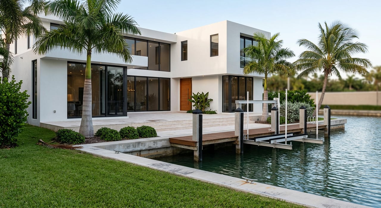
Docks, lifts, and seawalls
Lighthouse Point has precise rules for how far and how high you can build relative to the seawall. Dock extension, dock width by canal size, lift and davit setbacks, and safety ladder requirements are all controlled. Before you make an offer or list your home, review the city’s current standards in Lighthouse Point’s dock and seawall ordinance.
Permits matter. Confirm that any existing dock, lift, or seawall work was done with permits and final inspections. The city’s SmartGov permit portal lets you look up past approvals and check permit history.
Permits beyond the city
Work that affects submerged lands, mean high water, or navigation often needs state or federal approvals. Projects like major seawall replacement, dredging, or new slips can trigger state environmental permits and U.S. Army Corps review. To understand the state’s coastal and aquatic management framework, start with the statutes that govern public waters and sovereignty lands, such as Florida Statutes, Chapter 258.
Your real estate timeline should include time to research permits if your plans involve alterations to the shoreline or basin.
Insurance, flood, and risk
Seawall condition, elevation, and proximity to water influence insurance. Lenders and insurers may request an elevation certificate, seawall inspection, and proof of permitted work. Flood coverage pricing under NFIP’s Risk Rating 2.0 depends on multiple risk factors.
Start early with your insurance review. For flood risk basics and map tools, visit the FEMA Flood Map Service Center overview. Share your documents with your insurance broker upfront to avoid surprises before closing.
Due diligence checklist
Use this short list to validate dockage and access before you buy or sell:
- Map your full route to the ocean. List every bridge and control point. Cross‑check clearances with current NOAA chart listings.
- Measure your boat’s LOA, beam, draft, and air‑draft. Compare air‑draft to the Hillsboro A1A bridge’s approximate 13 ft closed clearance in this bridge listing.
- Order a recent dock sounding at low tide. For tight drafts, make it a professional survey requirement.
- Pull the city permit record. Use the SmartGov permit portal to confirm dock, lift, and seawall approvals.
- Get a seawall inspection if it is older or shows wear. Ask for remaining life and replacement cost.
- Confirm posted slow‑speed and no‑wake zones along your route. Use Florida Statutes Chapter 327 as your legal reference.
- If renting a marina slip, request written berth dimensions, piling layout, turning basin notes, and lift capacity from the office.
- Start insurance early. Share elevation certificates, seawall reports, and permits with your carrier. For flood risk tools, see FEMA’s overview.
- Check for dredging or bridge notices near your close date. Review the Coast Guard’s Local Notice to Mariners, such as this LNM example, and the Hillsboro Inlet District updates.
- Schedule a live on‑water trial from dock to inlet with a local captain if your boat has a tall tower or deeper draft.
When you understand bridges, depths, speed zones, and permits upfront, you protect your time and your investment. If you are weighing two homes with similar views, the one with cleaner access often wins in daily use and long‑term value. Ready to compare properties through a boater’s lens? Reach out to the GK Group for a private consultation tailored to your vessel and goals.
FAQs
What should I check before buying a waterfront home in Lighthouse Point?
- Verify bridge clearances, dock soundings at low tide, no‑wake segments, permit history for dock/lift/seawall, and insurance requirements.
How tall is the Hillsboro Inlet A1A bridge when closed?
- The reported closed vertical clearance is about 13 feet; plan an opening if your air‑draft exceeds that and confirm timing on the bridge listing.
Is Hillsboro Inlet safe for larger boats year‑round?
- Conditions change with shoaling and strong currents; review the Hillsboro Inlet District soundings, check the Coast Guard LNM, and consider local knowledge.
Do no‑wake zones add time to my ocean run?
- Yes, idle and slow‑speed areas near bridges, marinas, and inlet approaches can extend your trip, so include them in your timing.
How do I confirm if a dock or lift is legal?
- Pull the city’s permit history, review the Lighthouse Point dock and seawall ordinance, and ensure there are final inspections for the installed work.
What insurance documents should I gather early?
- Get an elevation certificate, any seawall or engineering reports, and copies of dock, lift, and seawall permits to share with your carrier and lender.